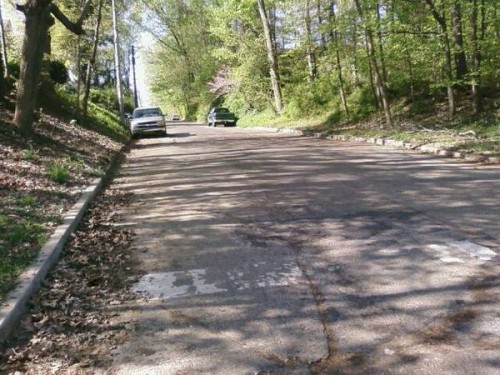
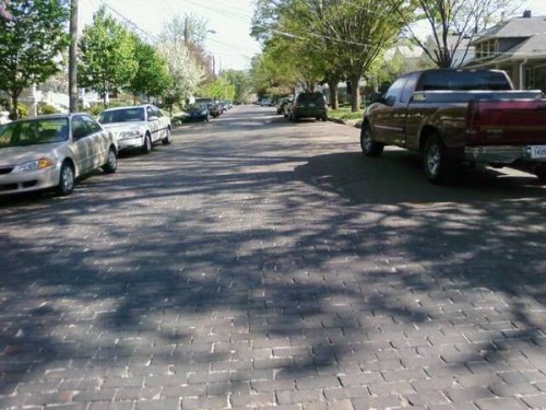
On Sunday, in France, the legendary* Paris-Roubaix race took place. It is a near-mythical jaunt across the cobbled farm roads of previously-war-torn Northern France. Some 140 miles of bone-jarring Napoleonic stones that make legends of some riders, but breaking far more. It is truly “epic”.
Inspired, I got out on the two-wheeler Sunday morning to find and ride what pavé (French for cobblestone) still exists in the 502, for what could be termed a pathetic but pleasant meh-pic homage.
There are relatively few of these area left in town that I know of. I haven’t given a whole lot of time to finding them, but given my life spent in this town coupled with the wisdom that only Google Maps Street View can provide, I found these handful of sections. They fall into one or two categories: ridiculously steep or quaintly maintained as a curio. I prefer the former.
As do many cycling trips in town, I started from Cherokee Park, riding a lap of the Scenic Loop, before getting to the proper steep stuff. You can find my entire route, “Crescent Hill Cobbles” on bikely.com
* legendary in cycling circles, anyway
Coming up after the jump, a pictorial of the journey and details.
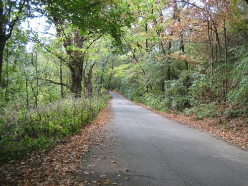
Appetizer: Maple Road, Cherokee Park
Length: 2100 feet.
Altitude gain: 101 feet.
Gradient: 5% average, 11% max.
[iframe: width="425" height="240" frameborder="0" scrolling="no" marginheight="0" marginwidth="0" src="http://maps.google.com/maps?f=q&source=embed&hl=en&geocode=&q=maple+road,+40204&sll=38.213545,-85.636762&sspn=0.012223,0.020685&ie=UTF8&hq=&hnear=Maple+Rd,+Louisville,+Jefferson,+Kentucky+40205&t=h&layer=c&cbll=38.23967,-85.69371&panoid=XJcT3N7hfE0ZC2QTSZw7Yw&cbp=13,42.92,,0,5&ll=38.250112,-85.686922&spn=0,0.048237&z=14&iwloc=A&output=svembed"]
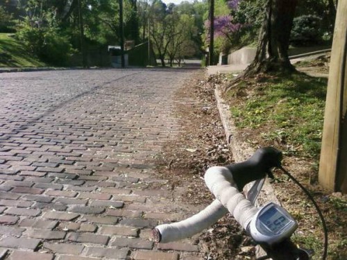
Sector #1: Peterson Avenue @ Grinstead Drive
Length: 529 feet
Altitude gain: 65 feet.
Grade: 8.8%
Old, weathered, at times unruly.
[iframe: width="425" height="350" frameborder="0" scrolling="no" marginheight="0" marginwidth="0" src="http://maps.google.com/maps?f=q&source=embed&hl=en&geocode=&q=peterson+ave&sll=38.213545,-85.636762&sspn=0.012223,0.020685&ie=UTF8&hq=&hnear=S+Peterson+Ave,+Louisville,+Jefferson,+Kentucky+40206&ll=38.260761,-85.693359&spn=0.003054,0.005171&t=h&z=14&layer=c&cbll=38.248743,-85.696991&panoid=XI52TcAj0MbrGgjyrAeVWg&cbp=12,0.48,,0,5&output=svembed"]
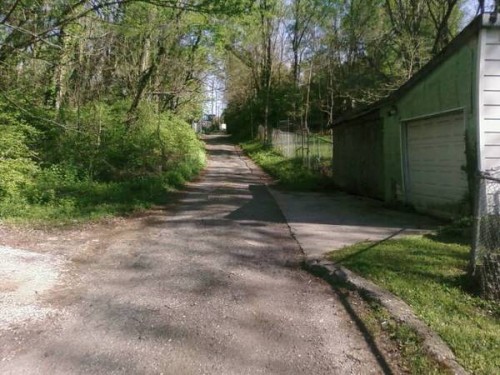
Sector #2: Bickel Alley between Payne Street and Bickel Road
Length: 700~ feet
Altitude gain: 50 feet
Grade: 6.5%
While not cobbled, it is a nasty stretch of uneven asphalt, concrete and gravel. Interesting collection of houses on the way up, as well.
[iframe: width="425" height="350" frameborder="0" scrolling="no" marginheight="0" marginwidth="0" src="http://maps.google.com/maps?f=q&source=embed&hl=en&geocode=&q=peterson+ave&sll=38.213545,-85.636762&sspn=0.012223,0.020685&ie=UTF8&hq=&hnear=S+Peterson+Ave,+Louisville,+Jefferson,+Kentucky+40206&ll=38.260761,-85.693359&spn=0.003071,0.005171&t=h&z=14&layer=c&cbll=38.249968,-85.702028&panoid=55q6ykbm7IEk2kT2wjqRvw&cbp=12,341.9,,0,5&output=svembed"]
You might also be interested in slogging up the nearby Saunders Avenue, just east of there. Not cobbled, but concrete slabs on a straight silly incline.
Sector #3 – Sycamore Avenue between Keats Avenue and Jane Street
Length: 420 feet
Altitude change/gradient: Eh.
Here lies an interesting curio. One block, untouched by the hot wrath of the asphalt-layer. Mostly flat with tidy paving bricks that deal a 10% quaintness bonus to all houses nearby.
[iframe: width="425" height="350" frameborder="0" scrolling="no" marginheight="0" marginwidth="0" src="http://maps.google.com/maps?f=q&source=embed&hl=en&geocode=&q=peterson+ave&sll=38.213545,-85.636762&sspn=0.012223,0.020685&ie=UTF8&hq=&hnear=S+Peterson+Ave,+Louisville,+Jefferson,+Kentucky+40206&ll=38.260761,-85.693359&spn=0.003071,0.005171&t=h&z=14&layer=c&cbll=38.255187,-85.701945&panoid=vAO9ebjkip6jrkCwf0C9Pg&cbp=12,270.39,,0,5&output=svembed"]
Sector #4 – Haldeman Avenue at Brownsboro Road (US 42)
Length: 449 feet.
Altitude gain: 49 feet.
Grade: 11.1%
What makes it worse is that many of the paving stones on Haldeman are actually laid into the street in a stair-step manner, I assume to keep cars from hurtling down it in damp or icy conditions. Imagine attempting to bike up your stairs, if they were 1/8 scale, and jagged.
PS – Apparently so fearsome that the Google Maps Street View car wouldn’t dare it!
[iframe: width="425" height="350" frameborder="0" scrolling="no" marginheight="0" marginwidth="0" src="http://maps.google.com/maps?f=q&source=embed&hl=en&geocode=&q=peterson+ave&sll=38.213545,-85.636762&sspn=0.012223,0.020685&ie=UTF8&hq=&hnear=S+Peterson+Ave,+Louisville,+Jefferson,+Kentucky+40206&ll=38.260761,-85.693359&spn=0.006141,0.010343&t=h&z=14&layer=c&cbll=38.259508,-85.710462&panoid=Hjb7YgKRFK262ow8Y8EIAg&cbp=12,191.07,,0,5&output=svembed"]
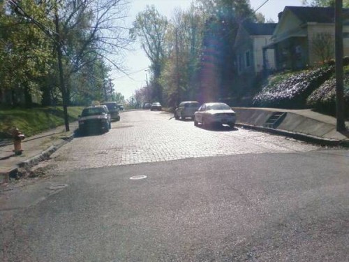
Sector #5 – State Street between Frankfort Avenue and North Charlton Street
Length: 968 feet
Altitude Gain: 34 feet
Grade: 3.5%
At the bottom, a tidy selection of stones as seen in the photo above, but at the top there is a wonderful patchwork of new and old stones, as seen below in the Google Street View.
[iframe: width="425" height="350" frameborder="0" scrolling="no" marginheight="0" marginwidth="0" src="http://maps.google.com/?ie=UTF8&hq=&hnear=3107+Hikes+Ln,+Louisville,+Jefferson,+Kentucky+40220&ll=38.255259,-85.716099&spn=0,0.005171&t=h&z=18&layer=c&cbll=38.255334,-85.716061&panoid=zsYy5R7pDlrSLvNTqeWvkw&cbp=12,190.62,,0,30.07&source=embed&output=svembed"]
After-dinner Coffee - Stevenson Avenue @ Mellwood Avenue
Length: 100 feet?
Altitude Gain: 23 feet
Grade: 23%
So this one isn’t cobbled, nor is it much longer than a baby’s arm, but it’s plenty steep.
[iframe: width="425" height="350" frameborder="0" scrolling="no" marginheight="0" marginwidth="0" src="http://maps.google.com/maps?f=q&source=embed&hl=en&geocode=&q=peterson+ave&sll=38.213545,-85.636762&sspn=0.012223,0.020685&ie=UTF8&hq=&hnear=S+Peterson+Ave,+Louisville,+Jefferson,+Kentucky+40206&ll=38.260761,-85.693359&spn=0.006142,0.010343&t=h&z=14&layer=c&cbll=38.256903,-85.719907&panoid=OPJ4IE_cnjMFjDPF43toIg&cbp=12,143.49,,0,5&output=svembed"]
Dessert – Mellwood Avenue to River Road and Mockingbird Valley
No need to blather on about this stretch. It’s not cobbled, it’s mostly flat and it’s beautiful. Mellwood Avenue is a tree-lined avenue with low traffic that runs from Old Louisville through to the affluent Mockingbird Valley. Mockingbird Valley is a rolling, tree-shrouded tour that intersects with Brownsboro Road. Say hello to the Dancing Bears, if you can find them.
[iframe: width="425" height="350" frameborder="0" scrolling="no" marginheight="0" marginwidth="0" src="http://maps.google.com/maps?f=q&source=embed&hl=en&geocode=&q=peterson+ave&sll=38.213545,-85.636762&sspn=0.012223,0.020685&ie=UTF8&hq=&hnear=S+Peterson+Ave,+Louisville,+Jefferson,+Kentucky+40206&ll=38.260761,-85.693359&spn=0.04912,0.082741&t=h&z=14&layer=c&cbll=38.275697,-85.692152&panoid=668j1vwfLEvkpMxu4aZOFw&cbp=12,108.35,,0,5&output=svembed"]


